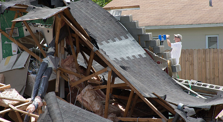
The massive collapse sinkhole spreading near Tampa, Fla. is being recorded as it develops with high-tech tools like three-dimensional (3D) laser scanners and drone 3D modeling. The resulting data is being used in new, immersive ways.
Researchers from the University of South Florida are spearheading this effort by creating a 3D reconstruction of the scene, both above and below the surface of the Pasco County sinkhole.
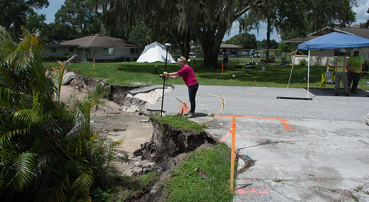
Lori Collins, PhD, research associate professor, USF Library, and co-director of the Alliance for Integrated Spatial Technologies, gathers data to build a 3D reconstruction of the Pasco County sinkhole.
Up until now, very few details have been collected on collapse sinkhole disasters in such a continuous way. This is in part because of the rapid nature of these phenomena and the need for advanced technologies and multidisciplinary approaches.
Lori Collins, PhD, co-director of the USF Library’s Digital Heritage and Humanities Collections, leads a team of researchers who are 3Dmapping the area. Collins’ team is collaborating with USF School of Geosciences researchers looking at the geophysics and underground characteristics, and mapping the bathymetry, or underwater terrain, of the nearby lake. Combining this mapping with various sets of data and with analysis of the historic environmental change as seen through maps that have been digitized and georeferenced, the USF researchers have built a picture of the site from the mid-1800s to present.
Many of the models can be viewed using virtual reality and are being 3D printed to allow comparisons in the shapes and extent of the sinkhole as it grows orchanges. The work will be archived in the USF library, allowing researchers and students to examine various aspects of the sinkhole.
Travis Doering, PhD, research associate professor, USF Library, and co-director of the Alliance for Integrated Spatial Technologies, use a 3D laser scanner at the site of the sinkhole.
“It will continue to provide a rich database of information, models, and ready-to-use curriculum to help improve our abilities to understand and respond to these types of disasters,” Collins said. “The database is an invaluable asset for students studying an array of subjects, especially geology, geography,environmental science, and urban planning.”
Collins, who grew up right around the corner from the sinkhole and remembers the land before homes were built on it, brings a heightened interest and historical perspective to her work. So far,seven homes have been condemned, and Collins drives by her old childhood home each time she works at the site.
- Photos courtesy of Lori Collins